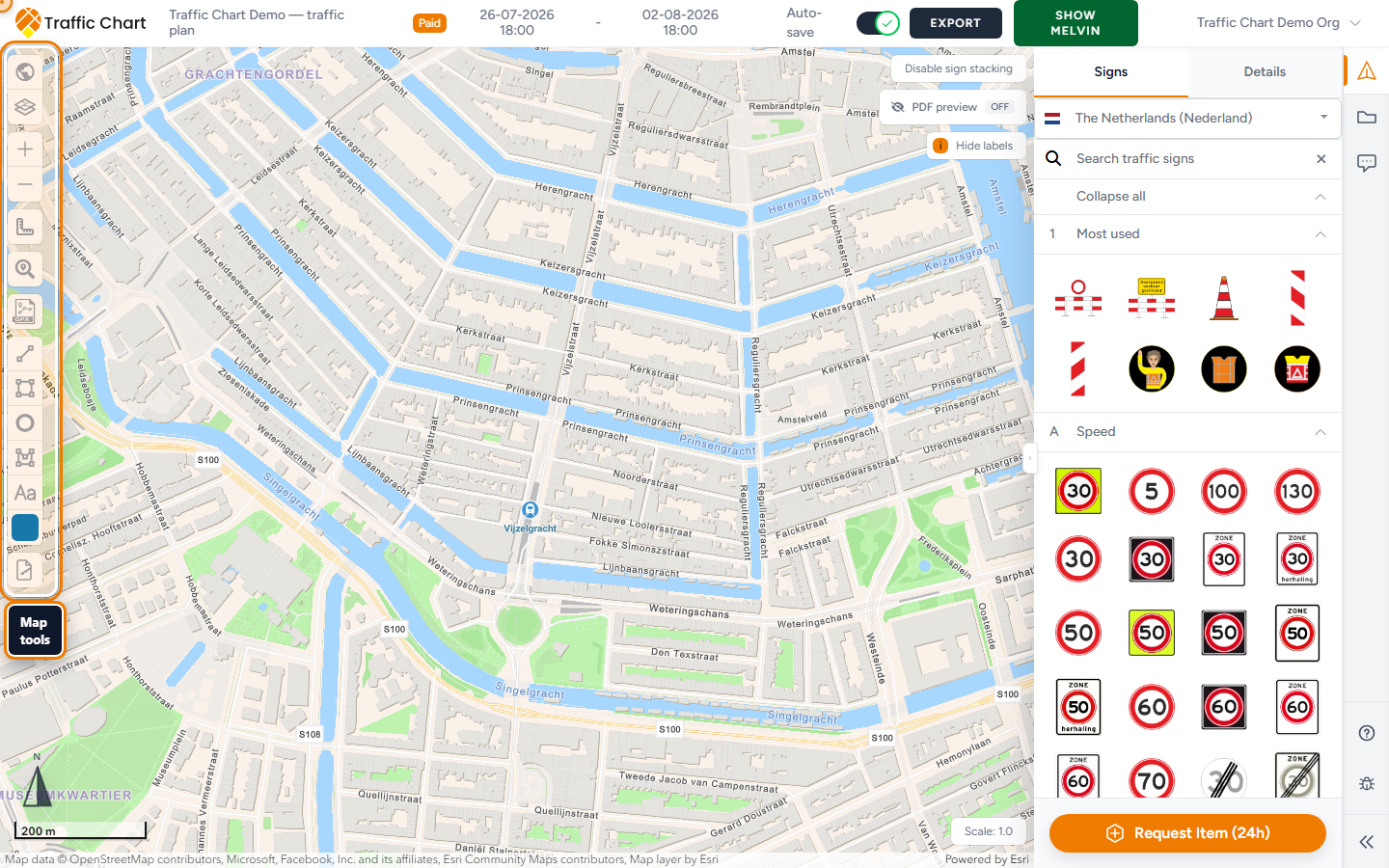
Find the works on the map, zoom until a sign click is precise, and set Scale: so objects print at a readable size. This page is Search address, Zoom in / Zoom out, pan, Scale:, and coordinates.
Use it when Demo traffic plan opens on the wrong city, signs look huge on a Detail export, or the scale slider is grey. Skip it to pick a sign from the catalogue.
Wait for the map
The editor opens full-screen. A branded overlay shows Opening Map Environment... and Loading geographical data & traffic signs.
Wait until that overlay is gone and street tiles are visible. Do not search or place signs on a white rectangle.
If the map stays blank: Map will not load or stays blank.
Search address
Search address is in the left tool stack (magnifying glass).
- Click Search address.
- The field appears with placeholder Type to search address.
- Type a street, place, or full address — for example a Utrecht junction, or an Amsterdam venue.
- Press Enter.
The map jumps to the first geocoded result. There is no separate search button. Enter runs the search and closes the field.
Try a fuller address if nothing useful appears: street, number, city, country. Neude, Utrecht beats Neude. A postcode plus city often works when a venue nickname does not.
Country versus address
Country on the plan loads the sign catalogue. Address search geocodes a place on the world map. They are not the same control.
A Netherlands catalogue with a Belgian street still searches. You will then place Dutch signs on a Belgian road. If the catalogue is wrong, start a new plan with the correct Country rather than hunting in Search traffic signs. Wrong country or missing traffic signs.
Confirm Country matches the area you are searching before you draw a lot of signs.
Zoom and pan
Left stack, under Layers & Objects:
- Zoom in
- Zoom out
Also:
- Mouse wheel zooms.
- Trackpad pinch or scroll zooms.
- Drag the background (not a selected sign) to pan.
Zoom in until placing a sign on a lane feels precise. Keep the works near the centre of the view before you draw export maps, so PDF pages frame the road rather than a field.
Read-only viewers (share link, or not the assigned editor) can still pan and zoom. They cannot change Scale:.
Zoom is how much map you see. Scale: is how large your signs and sketches are on that map. Zooming in does not shrink a sign for print. Lowering Scale: does.
Some Dutch layers only appear when you are close enough. You may see Zoom in further to show BGT objects. or Zoom in further to display fire hydrants. Those hints are the layer talking, not a broken search. Map layers and Melvin.
Scale
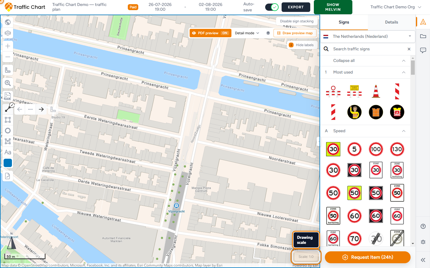
Scale: sits at the bottom right of the map.
Default 1.0. The slider runs from 0.1 to 1.0 in steps of 0.1. You cannot go above 1.0. Lower values shrink objects.
Click Scale: to open the slider. Move it, then release.
Lower scale shrinks signs, lines, and drawings relative to the basemap. Use 0.5 when a long Utrecht corridor must fit more objects on a Detail export page without covering the whole junction.
1.0 is the default for a single junction that already fits.
Set scale before you finalise many Detail export rectangles. After a change, those rectangles may be cleared (see confirm below). Re-check framing and sign size on Export.
Sketch tools and measurement are a different lesson: Drawing and measuring.
PDF preview locks the slider
While PDF preview is On, scale cannot change. Hover the control: Scale cannot be changed while PDF preview is on.
- Set PDF preview to Off.
- Change Scale:.
- Turn preview On again if you still need the paper rehearsal.
PDF preview is a Pro tool. Paying for unlimited signs (Paid) does not unlock it. Preview itself: PDF preview.
Confirm scale change
If the plan already has Detail export maps, changing scale opens Confirm scale change.
Body, with the value you picked (example 0.5):
To ensure optimal results with the new scale (0.5), your detail export maps will be reset and need to be redefined. The scale function gives you more control over the size of objects like lines and traffic signs.
Notes:
- Scale 1.0 is the default. If you lower the scale (e.g., to 0.5), all objects will shrink, and detail export maps must be redrawn. This helps keep traffic signs readable when exported or printed.
- PDF preview and XL maps will be kept because their scale is based on the selected export map.
Buttons: Confirm and Cancel.
Confirm applies 0.5 (or whatever you chose) and clears Detail rectangles. You redraw those maps. XL maps and PDF preview framing stay.
Cancel keeps the previous scale. The slider closes.
If there are no Detail maps, the confirm dialog does not appear. The new scale applies immediately.
After a confirmed change, open Export and redraw Detail maps before you send a PDF. Export and print traffic plans.
Coordinates and Address
Select a sign stack. Open Traffic Objects → Details.
Coordinates: Latitude and Longitude.
Address shows the reverse-geocoded street when the app has one.
Use Search address to jump around. Use Latitude / Longitude when a contractor asks for an exact point. Empty Details: No sign selected. Typing a latitude does not move the map the way Search address does.
Worked example
Sam Rivera opens Demo traffic plan for Utrecht.
- Wait until Opening Map Environment... is gone and tiles show.
- Search address, type the works street in Type to search address, Enter.
- Zoom in until one junction fills the view.
- Scale: is 1.0. The corridor is long, so Sam chooses 0.5.
- Confirm scale change appears because Detail maps already exist. Sam reads that those maps will be reset, clicks Confirm, and redraws them.
- A contractor asks for a point. Sam selects the stack, Details, copies Latitude and Longitude.
If Sam had left PDF preview On, the slider would stay grey with Scale cannot be changed while PDF preview is on.
Practical rhythm
- Wait until Opening Map Environment... is gone.
- Search address → Type to search address → Enter.
- Zoom in until a pole location is obvious.
- Set Scale: (often leave 1.0; use 0.5 for a long corridor) before lots of Detail maps.
- Place signs.
- Pan by dragging the background to check nearby junctions.
What good looks like
The map is on the Utrecht (or Amsterdam) works, not a default city you never chose. Tiles are visible. Signs sit on the carriageway at a size that will still read on PDF. Scale: matches the export you intend. PDF preview is Off when you need to move the slider. Details shows Latitude and Longitude for a selected stack.
If something blocks you
| Situation | What to try |
|---|---|
| Overlay never clears, or the map is white | Map will not load or stays blank |
| Search jumps to the right street, wrong signs | Wrong Country — Wrong country or missing traffic signs |
| Scale cannot be changed while PDF preview is on. | PDF preview Off |
| Confirm scale change surprised you | Cancel if you cannot redraw Detail maps yet |
| Cannot pan or the tools are missing | Read-only or locked — I can’t open or edit a plan |
| Need paper rehearsal, not object size | PDF preview |